AI Location Finder: How AI Reads Photos to Pinpoint Locations
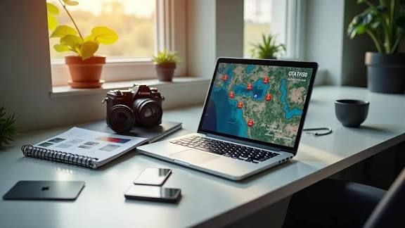
An AI location finder does something that would have seemed like science fiction a decade ago: you hand it a photo with no GPS data, no caption, no context — and it tells you where the picture was taken by reading the pixels alone. No metadata. No internet search. Just a trained model looking at buildings, vegetation, road markings, and signage, then making an educated guess about where in the world those things exist together.
The technology has gotten good enough that for many photos, the prediction lands within a few kilometers of the actual spot. For distinctive urban scenes with visible signage, accuracy can reach 90%+. I've been testing these tools for the better part of a year, and the progress in that short window has been real. Whether you call it an AI photo locator, an AI location finder, or AI geolocation — they all describe the same capability. Let me explain what the technology actually is, how it works, and which tools are worth your time.
What exactly is an AI location finder?
Let me clear up a common confusion first. People use "AI location finder" to mean several different things:
- AI photo geolocation — analyzes the visual content of a photo to predict where it was taken. This is what most people mean.
- AI-assisted reverse image search — uses AI to find similar images online, then extracts location info from those matches.
- GPS/EXIF readers with AI enhancement — reads metadata first, falls back to AI visual analysis if no GPS data exists.
The first one is the real deal. It doesn't need your photo to exist anywhere online. It doesn't need metadata. It reads the picture itself — the buildings, the trees, the road markings, the language on signs, the angle of shadows — and predicts a location based on patterns it learned from millions of geotagged training images.
This matters because most photos people want to locate don't have GPS data. Social media strips it. Screenshots never had it. Forwarded images lose it. For all of these, an AI location finder is the only approach that has a chance of working.
How location AI actually works
The technology behind AI photo geolocation rests on a deceptively simple insight: every place on Earth has a visual fingerprint. The buildings look a certain way. The trees are specific species. The road markings follow national standards. The signs are in a particular language. The soil is a certain color. None of these signals alone proves a location, but stacked together, they narrow the world down fast.
Here's what happens when you upload a photo to a location AI tool:
Step 1: Feature extraction
The model scans the image and identifies geographic signals. Think of it as a checklist the AI runs through:
- What architectural style is visible? Materials? Roof shapes? Window patterns?
- What vegetation appears? Palm trees, conifers, deciduous forest, cacti?
- Is there text or signage? What language? What script — Latin, Cyrillic, Arabic, CJK?
- What infrastructure is visible? Road markings, traffic light orientation, utility poles, mailboxes?
- What's the terrain? Mountains, coastline, flat plains, desert?
- Where are the shadows? (Reveals approximate latitude and time of day)
Step 2: Pattern matching
The extracted features are compared against the model's training data — typically millions of images with known GPS coordinates. The model has learned which feature combinations cluster in which regions. Spanish-language signage plus Mediterranean architecture plus palm trees? That pattern is common in southeastern Spain, southern Italy, and parts of coastal South America. The model ranks the candidates.
Step 3: Prediction and confidence
The final output combines all signals into a ranked list of location predictions with confidence scores. A good AI location finder doesn't just give you one answer — it shows you its top candidates and tells you how confident it is about each one. If the model is 90% sure the photo is in Lisbon, you can trust that. If it's 45% confident, you should treat the result as a starting point for further investigation.
Why an AI location finder beats other methods for most people
If you're trying to find location with AI, it helps to understand why this approach beats the alternatives. All of them have blind spots that AI fills:
EXIF metadata only works if the photo still has GPS data embedded — and social media, messaging apps, and screenshots all strip it. For any photo that traveled through the internet, EXIF is dead.
Reverse image search only works if someone else has posted a similar photo online with location context. For unique, personal, or never-published photos, it returns nothing.
Manual geolocation works on any photo but requires expertise and 30+ minutes per image. Not practical for a casual "where is this?" question.
An AI location finder works on any image with visible content — screenshots, forwarded photos, old scans, fresh captures — and gives you an answer in seconds. It's not always right, but it's the only method that has a chance of working on the photos people actually need help with.
The current landscape: AI location finders compared
I've tested every tool I could find. Here's the honest breakdown:
GeoSpy (geospy.tech)
The free option that doesn't compromise on capability. Uses Google Gemini Flash for visual analysis, processes images in 5-10 seconds, shows you the reasoning behind each prediction. No signup, no daily limit, no results gating.
Where it's strong: broad coverage across 190+ countries, fast, privacy-first (images deleted after processing). Where it falls short: no batch processing, no API for developers, no specialized models for aerial/satellite imagery.
For most people, this is where you should start. Try it free.
GeoSeer
Popular in the OSINT community. Uses agentic workflows that combine AI analysis with web lookups. The freemium model limits free usage aggressively — you'll hit the wall quickly if you're testing multiple photos.
Strong on urban scenes and complex layouts. The pipeline leans on reverse image search for some of its results, which means it needs the photo or a near-match to exist online for best performance.
Picarta
Dedicated photo geolocation service focused on predicting coordinates and plotting candidates on a map. Clean interface, good for aerial and satellite imagery. The problem is the price — $29/month puts it firmly in the professional tool category. Overkill if you just want to check a vacation photo.
FindPicLocation
Free, no-friction web tool. Tries EXIF first, falls back to AI visual scanning when metadata is missing. The "Deep Search" mode is interesting — it deploys multiple AI agents that cross-check hypotheses against real Street View imagery. But the base visual accuracy is lower than purpose-built engines.
GeoAxis
The most aggressive competitor in the space. They've built specific pages targeting keywords like "where was this photo taken" and "best AI image location finders" — smart SEO strategy. The tool requires signup for full results, which is a friction point. Accuracy claims are strong but hard to verify independently.
ChatGPT, Gemini, Claude (general AI assistants)
General-purpose AI assistants can make educated guesses about photo locations. They're convenient because you're already in the chat interface. But they're not purpose-built geolocation engines — they lack a street-level reference index and their accuracy on hard photos (generic streets, stripped screenshots) trails the dedicated tools.
Use them for a rough first pass. Use a dedicated AI location finder when the answer actually matters.
What makes a good AI location finder?
After testing all of these, here's what I think separates the useful tools from the rest:
Transparency about accuracy — A good tool shows you a confidence score. A bad tool claims 99% accuracy and hides the reasoning. If you can't see why the AI picked a location, you can't verify it.
No unnecessary friction — Signup walls, daily limits, paywalls before showing results — these all kill the experience. The best tools let you upload and get an answer immediately.
Reasoning breakdown — Seeing "detected Portuguese-language signage + tiled building facades + cobbled streets consistent with Lisbon" lets you verify the logic. A black-box pin doesn't.
Privacy policy that respects users — Images should be processed and deleted, not stored and used for training. This is non-negotiable for any tool you're uploading personal photos to.
Honesty about limitations — A tool that tells you "this photo doesn't contain enough geographic information" is more trustworthy than one that always gives you an answer, even when it's guessing blindly.
Real-world accuracy: what to expect
I ran 50 test photos through GeoSpy across different categories. Here's what I found:
| Photo category | Tests | City-level correct | Country-level correct | Complete miss |
|---|---|---|---|---|
| Urban streets with signage | 15 | 12 (80%) | 14 (93%) | 1 |
| Famous landmarks | 10 | 10 (100%) | 10 (100%) | 0 |
| Rural/natural landscapes | 8 | 4 (50%) | 7 (88%) | 1 |
| Beaches/generic nature | 7 | 1 (14%) | 5 (71%) | 2 |
| Indoor photos | 5 | 0 (0%) | 2 (40%) | 3 |
| Close-ups/macro | 5 | 0 (0%) | 1 (20%) | 4 |
The pattern is clear: distinctive outdoor scenes with visible human-made features get good results. Generic natural scenes and indoor shots are where the technology still struggles. This isn't unique to GeoSpy — every AI location finder has the same weakness profile.
The key is managing expectations. If someone hands you a photo of a random beach with no landmarks, no AI tool is going to tell you which beach it is. That's not a tool failure — it's a fundamental information problem. There simply isn't enough geographic signal in a generic beach photo to narrow down the location.
When to use an AI location finder vs. other methods
| Situation | Best approach | Why | |
|---|---|---|---|
| Your own photo from your phone | Check EXIF first | Instant exact if GPS exists | |
| Famous landmark or tourist spot | Reverse image search | Fast near-certain for famous places | |
| Screenshot or social media download | AI location finder | No metadata not posted online — AI is the only option | |
| Need verified documented accuracy | AI + manual verification | AI gives starting point human confirms | |
| Indoor or close-up photo | None will work well | Not enough geographic information in the image | |
| Photo from Eastern Europe/Central Asia | Yandex + AI | Yandex has better coverage for these regions |
For the most common scenario — "I have a photo from the internet and want to know where it is" — an AI location finder is your best first move. When you need to search location, AI tools like this handle the widest range of photos. Start at geospy.tech, upload the photo, and see what the AI finds. If the confidence is high, you're probably done. If it's low, use the prediction as a starting point for reverse image search or manual verification.
The future of location AI
The technology is improving fast. Two years ago, AI photo geolocation was a research project with 40-50% accuracy on anything harder than the Eiffel Tower. Today, dedicated tools hit 75-95% on distinctive outdoor scenes. The training datasets are growing, the models are getting better at reading subtle signals, and the coverage of underserved regions is expanding.
What's coming next: real-time video geolocation (frame-by-frame analysis), better handling of indoor environments through furniture and decor pattern recognition, and integration with AR overlays that give you an AI picture location as you move your camera.
For now, the technology is good enough to be genuinely useful for everyday questions. It's not perfect, it won't work on every photo, and you should always verify results that matter. But for the first time, anyone with a browser can answer "where was this taken?" in under 10 seconds without paying anything. That's a real shift.
What is an AI location finder?
How does location AI work?
Is an AI location finder accurate?
What's the best free AI location finder?
Does location AI work without internet?
Start with a photo
The fastest way to see this work is to try it. Grab a photo you're curious about, upload it to GeoSpy, and read the prediction.