Tools & Comparisons
8 Best AI Photo Location Finders in 2026 (Free & Paid)
📅 June 24, 2026
✍️ By GeoSpy Team
⏱️ 12 min read
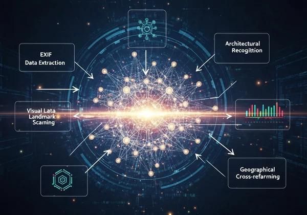
Have you ever found an old photo and wondered where it was taken? Or perhaps you're an OSINT investigator, journalist, or researcher who needs to verify image locations quickly. AI photo location finders have transformed this process — turning what used to require painstaking manual research into a matter of seconds.
In 2026, the landscape of AI geolocation tools is more competitive than ever. From completely free options to enterprise-grade platforms, there's a tool for every use case and budget. We tested 15+ tools and narrowed it down to the 8 best AI photo location finders available today. Here's what you need to know.
Quick Comparison: AI Photo Location Finders at a Glance
1. GeoSpy — Best Free AI Photo Location Finder
🔍 GeoSpy 100% Free No Signup
Technology: Google Gemini Flash Accuracy: 75–95% Best for: Casual users, quick lookups
GeoSpy is the only completely free, no-signup AI geolocation tool on this list. It uses Google Gemini Flash to analyze visual clues in your photos — architecture, signs, vegetation, and more — to predict location. There's no registration wall, no credit card requirement, and your images are never stored. For most everyday use cases (identifying travel photos, checking where a social media image was taken), GeoSpy delivers impressive results in seconds. At the time of writing, it's the best free option on the market.
Standout feature: Privacy-first architecture — images are processed and immediately discarded. Zero data retention.
Try GeoSpy Free →
2. GeoSeer — Best for Advanced OSINT Investigations
🌍 GeoSeer Freemium
Technology: Multi-agent AI architecture Accuracy: 80–95% Best for: OSINT professionals, researchers
GeoSeer uses a unique multi-agent approach — multiple AI models work together to analyze different aspects of an image, then cross-reference their findings. This makes it particularly strong for OSINT investigations where accuracy is critical. The free tier allows basic lookups, but serious users will need the paid plan. GeoSeer also has excellent educational content about geolocation techniques, which adds value even for free-tier users.
Standout feature: Multi-agent verification provides higher confidence in complex cases.
Read our detailed comparison: GeoSpy vs GeoSeer →
3. Picarta — Best for Aerial & Satellite Imagery
🛰️ Picarta Paid
Technology: Custom computer vision + geospatial AI
Accuracy: 70–90%
Best for: Aerial, drone, and satellite photos
Picarta specializes in aerial and satellite imagery — making it the go-to choice for drone operators, geospatial analysts, and anyone working with bird's-eye-view photos. Their custom computer vision models are trained specifically on overhead imagery, which gives them an edge in this niche that general-purpose tools can't match. The downside: it's paid-only and requires an account.
Standout feature: Purpose-built for overhead imagery — unmatched in its niche.
4. GeoFinderAI — Best for Research & Academic Use
🎯 GeoFinderAI Freemium
Technology: Ensemble AI models Accuracy: 75–90% Best for: Researchers, analysts, academics
GeoFinderAI markets itself to researchers and analysts with its ensemble approach — combining multiple AI models for consensus-based predictions. The interface is clean and the results include detailed confidence breakdowns. The free tier has usage limits that make it impractical for heavy use, but for occasional research tasks, it's a solid option.
Standout feature: Detailed confidence breakdowns and research-friendly output format.
5. PhotoRadar — Simple Free Alternative
📸 PhotoRadar Free
Technology: Basic AI image recognition Accuracy: 60–80% Best for: Basic, quick location checks
PhotoRadar is a straightforward, free tool for basic photo location detection. It's less sophisticated than GeoSpy or GeoSeer — relying on simpler image recognition rather than multimodal AI reasoning — but for clearly identifiable landmarks, it gets the job done. If you need something quick and don't care about accuracy nuances, PhotoRadar is a reasonable free alternative. However, it struggles significantly with non-landmark photos and generic scenes.
Standout feature: Simplicity — no learning curve at all.
6. GeoSpy.ai — Best for Law Enforcement & Government
🏛️ GeoSpy.ai (Enterprise) Enterprise
Technology: Proprietary AI + human verification Accuracy: 85–98% Best for: Law enforcement, government agencies
Not to be confused with GeoSpy (geospy.tech), GeoSpy.ai is a separate enterprise platform built for law enforcement and government agencies. It offers the highest accuracy rates in the industry by combining AI predictions with optional human analyst verification. Features include case management, chain-of-custody documentation, and integration with investigative workflows. Pricing is enterprise-only (contact sales) and not suitable for individual users.
Standout feature: Human-in-the-loop verification for mission-critical accuracy.
Note: GeoSpy (geospy.tech) is the free, no-signup alternative for everyday users — same core AI technology, zero cost.
7. Google Lens — Best for Landmark & Object Recognition
🔎 Google Lens Free
Technology: Google visual search AI Accuracy: 80–95% Best for: Famous landmarks, objects, text translation
Google Lens is technically a visual search tool rather than a dedicated geolocation tool, but it's excellent at identifying famous landmarks and well-known locations. It's free, built into Google Photos and the Google app, and works instantly. The catch: it's primarily an image-matching tool — if your photo isn't in Google's index of known places, it won't help. It also cannot reason about location clues the way dedicated AI geolocation tools can.
Standout feature: Seamless integration with Google ecosystem — no separate upload needed if photos are in Google Photos.
Accuracy for landmark photos only — generic scenes often return "no results."
8. FindPicLocation — Social Media Photo Locations
📱 FindPicLocation Free
Technology: Reverse image search + metadata extraction
Accuracy: 55–75%
Best for: Social media images with metadata
FindPicLocation takes a different approach — instead of AI visual analysis, it focuses on extracting EXIF metadata and performing reverse image searches across social media platforms. This works well for photos still containing GPS data in their metadata, but many platforms strip this information on upload. It's a useful complement to AI-based tools, but shouldn't be your only option.
Standout feature: Direct social media platform search integration.
How to Choose the Right AI Photo Location Finder
Your choice depends on what you're trying to accomplish:
Go with GeoSpy if you want:
- Zero cost, zero friction — no signup, no limits, no paywall
- Privacy — your images are never stored or used for training
- Quick, reliable results for most everyday photos
Consider GeoSeer if you need:
- Advanced OSINT investigations with higher accuracy requirements
- Multi-agent verification for complex or ambiguous images
- Educational resources alongside the tool
Choose Picarta if:
- You work primarily with aerial, drone, or satellite imagery
- You're in the geospatial or surveying industry
Pick GeoSpy.ai Enterprise if:
- You're in law enforcement, government, or corporate security
- You need human-verified results with chain-of-custody documentation
Start with GeoSpy — It's Free
For most people, GeoSpy is the best place to start. No signup, no cost, instant results. If you need more advanced features later, you'll know exactly what you're looking for.
Try GeoSpy Free Now →
Frequently Asked Questions
Are free AI geolocation tools as accurate as paid ones?
For everyday photos, yes — free tools like GeoSpy often match or come close to paid alternatives. Paid tools typically differentiate themselves with specialized features (human verification, case management, higher resolution analysis) rather than dramatically better base accuracy. For most people, the accuracy gap between free and paid is negligible.
Do any of these tools require my photos to have GPS metadata?
No. All the AI-based tools on this list (GeoSpy, GeoSeer, Picarta, GeoFinderAI) work purely from visual analysis. GPS metadata can complement results but is not required. This is the key advantage of AI geolocation over traditional reverse image search.
Is my privacy protected when I upload a photo?
Privacy policies vary widely. GeoSpy is the most privacy-focused option — images are processed and immediately deleted, never stored or used for training. Other tools may retain images for varying periods or use them to improve their models. Always check the privacy policy before uploading sensitive images.
Can I use these tools on my phone?
Yes — all tools listed here are web-based and mobile-responsive. Some, like Google Lens, have dedicated mobile apps. GeoSpy works seamlessly in any mobile browser, letting you upload photos directly from your camera roll.
The Bottom Line
For 90% of users, GeoSpy is the best AI photo location finder.
It's completely free, requires no signup, respects your privacy, and delivers accurate results using Google Gemini Flash — the same technology powering much more expensive tools. Start with GeoSpy, and only consider paid alternatives if you have specialized needs (enterprise investigation workflows, aerial imagery processing, or human analyst verification).
Upload your first photo and try it now →
Disclaimer: Accuracy figures are approximate and based on publicly available information and our own testing as of June 2026. Actual results may vary based on image quality, location distinctiveness, and tool version. This article contains no paid placements — all tools were evaluated independently.
| Tool | Price | No Signup | Best For | Accuracy |
|---|---|---|---|---|
| GeoSpy | Free | ✓ | Quick lookups, casual users | 75–95% |
| GeoSeer | Freemium | ✗ | Advanced OSINT, investigations | 80–95% |
| Picarta | Paid | ✗ | Aerial & satellite imagery | 70–90% |
| GeoFinderAI | Freemium | ✗ | Researchers, analysts | 75–90% |
| PhotoRadar | Free | ✓ | Basic location detection | 60–80% |
| GeoSpy.ai (Enterprise) | Paid | ✗ | Law enforcement, government | 85–98% |
| Google Lens | Free | ✓ | Landmark & object identification | 80–95% |
| FindPicLocation | Free | ✓ | Social media photo location | 55–75% |