Search Location by Image: The AI Image Search Guide
Searching for a location using an image used to mean one thing: uploading your photo to Google and hoping someone else had posted a similar picture with a caption. If nobody had, you were out of luck. The photo could show a random street corner in Lisbon or a beach in the Philippines, and there was no way to find out which one — unless you were willing to spend hours playing detective with Google Earth.
That's changed. AI image search has made it possible to search location by image even when the photo has never been posted online, has no metadata, and shows no famous landmarks. The technology reads the visual content of the image and predicts where it was taken based on patterns it learned from millions of geotagged photos.
This guide covers how to search location by image using every method available today, when each one works, and which one you should try first.
The two approaches to searching location by image
People use "search location by image" to mean two different things, and the distinction matters:
Approach 1: Reverse image search
This is the old-school method. You upload a photo to a search engine, and it looks for visually similar images across the web. If it finds a match — say, your photo of a building shows up on a travel blog with a caption saying "the old town of Dubrovnik" — you've got your location.
When it works: Famous landmarks, widely photographed places, images that have been posted online before. Google Lens, Yandex Images, and TinEye all do this.
When it fails: Personal photos, screenshots, images that have never been published anywhere. If nobody has posted a similar picture, reverse search returns nothing.
Approach 2: AI image search (AI geolocation)
This is the newer method. Instead of looking for a copy of your photo online, an AI model analyzes the visual content of the image itself — the architecture, the vegetation, the signage, the terrain — and predicts where in the world that combination of features exists.
When it works: Almost any photo with visible outdoor content. Screenshots, personal photos, images with no online presence. The AI reads the picture, not the internet.
When it fails: Indoor photos, close-ups, generic natural scenes with no distinctive features.
For most people reading this, Approach 2 is what you're looking for. It handles the widest range of photos and doesn't depend on the image existing anywhere online.
How to search location by image: step by step
Step 1: Try AI geolocation first
This is your starting point for 90% of photos. It's fast, free, and works on images that no other method can handle. If you need to find location from picture content alone, this is where you start.
- Open GeoSpy in any browser — desktop or mobile
- Upload your photo (JPEG, PNG, WebP, HEIC, up to 20MB)
- Wait 5-10 seconds for the AI to analyze
- Review the prediction: map pin, coordinates, predicted city/region, confidence score, and reasoning breakdown
The reasoning breakdown is important. It tells you why the AI picked that location — "detected Spanish-language signage + Mediterranean architecture + palm trees consistent with southeastern Spain." This lets you verify the logic rather than trusting a black box.
If the confidence is high (80%+), you're likely done. If it's low (under 50%), use the prediction as a starting point and move to the next steps.
Step 2: Cross-reference with reverse image search
If the AI gave you a prediction but you want to verify, or if the AI struggled with your photo, try reverse image search.
Google Lens — The biggest index. Best for Western landmarks and widely-photographed locations. Point it at a recognizable building and it'll often identify the place instantly. Available at lens.google.com or through the Google app.
Yandex Images — Don't skip this. Yandex has better coverage for Eastern Europe, Russia, Central Asia, and parts of Asia than Google. I've seen Yandex nail locations that Google, TinEye, and Bing all missed — a residential street in Almaty, a roadside scene in rural Bulgaria. The interface is in Russian, but browser translation handles that.
TinEye — The oldest and most reliable for finding exact copies of your image online. Less useful for location-finding (it finds where the image has been published, not where it was taken), but valuable if you're trying to trace an image's origin.
Run your photo through at least two engines. Each one has different coverage, and combining results dramatically improves your hit rate.
Step 3: Check for EXIF GPS data
If the photo came from your own camera or was sent to you directly (not through social media), it might still have GPS coordinates embedded in its metadata.
Mac: Right-click → Open With → Preview → Tools → Show Inspector → GPS tab Windows: Right-click → Properties → Details → look for GPS data Online: Jeffrey's Image Metadata Viewer exifdata.com
If GPS data exists, you're done — it gives you exact coordinates. But for most internet-sourced photos, this data has already been stripped by the platform that hosted or shared the image.
Step 4: Manual verification
If you have a prediction from the AI and want to confirm it, drop the predicted coordinates into Google Maps and switch to Street View. If the buildings, signage, and street layout match your photo, you've got strong confirmation.
For a deeper dive on manual geolocation techniques, our manual geolocation guide covers each signal category — architecture, vegetation, infrastructure, shadows — with real examples.
AI image search vs. reverse image search: what's the difference?
This question comes up constantly, so let me be precise about the distinction.
Reverse image search takes your photo and asks: "Does this image, or something visually similar, exist somewhere on the internet?" If yes, it shows you where. The technology is essentially a similarity-matching algorithm operating against a database of indexed web images.
AI image search (AI geolocation) takes your photo and asks: "Based on what I can see in this image, where in the world was it taken?" The technology is a computer vision model that reads geographic signals from the photo's content and matches them against patterns learned from millions of geotagged training images.
The difference is fundamental:
| Aspect | Reverse Image Search | AI Image Search |
|---|---|---|
| What it needs | Photo to exist online (or a similar match) | Just the photo's visual content |
| What it returns | Where the image has been published | Where the photo was likely taken |
| Works on screenshots? | Rarely | Yes |
| Works on unique photos? | No | Yes |
| Works on famous landmarks? | Yes very well | Yes very well |
| Works on generic street scenes? | No | Often if features are distinctive |
| Technology | Image similarity matching | Computer vision + geolocation AI |
They're complementary, not competing. Reverse image search is better for tracing an image's online history. AI image search is better for determining a photo's real-world location. When you search by photo using both methods, you get the best chance of an accurate answer.
Which tools to use for image-based location search
Not every image location finder is worth your time. Here are the ones I recommend:
| Tool | Type | Free? | Best For | Limitation |
|---|---|---|---|---|
| GeoSpy | AI geolocation | Free no signup | Any photo with visual content | No batch no API |
| Google Lens | Reverse search | Free | Famous landmarks objects | Not true geolocation |
| Yandex Images | Reverse search | Free | Eastern Europe Russia Asia | Russian interface |
For most people, the workflow is simple: start with GeoSpy (free AI geolocation), then verify with Google Lens or Yandex (reverse search). That combination handles the vast majority of location-finding needs at zero cost.
What kind of images work for location search?
Not every photo contains enough information for location identification. Here's a rough guide:
High success rate
- Urban street scenes with visible buildings, signage, and infrastructure
- Famous landmarks — the AI and reverse search both nail these
- Rural scenes with distinctive regional architecture or terrain
- Photos with text in a recognizable language or script
- Natural landmarks — distinctive mountain ranges, coastlines, geological formations
Medium success rate
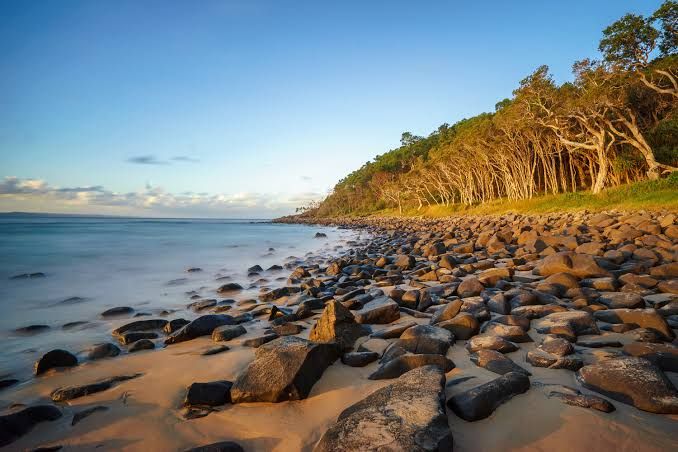
- Beaches and coastal scenes — the AI might identify the country but rarely the specific beach
- Generic cityscapes — glass-and-steel towers could be in many cities
- Rural landscapes without distinctive architecture
- Photos with partial visibility — some geographic clues but not enough for high confidence
Low success rate
- Indoor photos — no geographic context to read
- Close-ups and macro shots — no environmental information
- Abstract or artistic images — nothing geographic to identify
- Heavily filtered or edited photos — the AI reads the original content, not the effects
- Very low resolution or blurry images — less visual data for the AI to work with
The honest truth: if a photo doesn't contain visible geographic information, no tool can extract location from it. This isn't a technology limitation — it's an information problem. You can't identify the location of a photo of a white wall because a white wall could be anywhere.

Privacy considerations for image-based location search
Whenever you upload a photo to a web-based tool, consider what happens to that image:
GeoSpy — Images are processed in memory and deleted immediately. Not stored, not used for training. The most privacy-respecting option.
Google Lens / Yandex / TinEye — These are major tech companies with complex data policies. Your uploaded images may be retained for varying periods. Read their privacy policies if this concerns you.
Other AI tools — Policies vary widely. Some store images for "model improvement." Some retain images indefinitely. Always check before uploading anything sensitive.
Never upload: Government IDs, passport photos, financial documents, anything containing personal information, anything you wouldn't want a third party to see. Even with deletion policies, the image exists on a server during processing.
For private, on-device analysis: EXIF checking is the only method that keeps your photo entirely on your computer. Everything else involves uploading to a remote server.
How do I search for a location using an image?
What is AI image search for location?
Can I search location by image for free?
What's the difference between searching location by image and reverse image search?
Can I find the location of a photo someone sent me?
Ready to learn more?
The fastest way to see this work is to try it. Grab a photo you're curious about, upload it to GeoSpy, and read the prediction.